Trying to choose between Alameda’s waterfront lifestyle and the Historic East End? It is a smart question, because in Alameda, where you live can shape how you commute, run errands, spend weekends, and even what you may need to know about preservation or shoreline planning. If you are weighing views and ferry access against classic streets and walkable daily routines, this guide will help you compare the two with more confidence. Let’s dive in.
Why This Alameda Comparison Matters
Alameda is an island city of about 80,000 residents connected to the mainland by four bridges, two underwater tubes, and three ferry terminals. The city also notes that most streets have sidewalks and bikeways, so your location can have a big impact on how easy it feels to get around day to day.
The comparison also matters because Alameda offers two very different living patterns. On one side, you have shoreline areas shaped by open space, ferries, and larger retail centers. On the other, you have historic districts and older neighborhood grids centered around Park Street and nearby blocks.
Alameda’s built environment adds another layer. The city says there are more than 10,000 buildings constructed before 1930, which helps explain why the East End often feels more architectural and established, while some waterfront areas feel newer, more mixed-use, or redevelopment-driven.
Waterfront Living in Alameda
When people say “waterfront Alameda,” they are usually describing several different shoreline areas rather than one single neighborhood. City planning materials distinguish Alameda Point, South Shore, Bay Farm Island, and northern estuary areas, each with different land uses, transit options, and shoreline conditions.
That distinction is important if you are buying for lifestyle fit. A waterfront home near Alameda Point can feel very different from one near South Shore or Bay Farm Island, even though all may fall under the same broad label.
What Waterfront Lifestyle Feels Like
In general, waterfront living in Alameda tends to appeal to buyers who value views, shoreline paths, open space, and a more destination-based routine. You may spend more time near beaches, promenades, ferry terminals, and larger shopping centers than on traditional main streets.
Alameda Point is a strong example of this newer waterfront identity. The city describes it as a former naval air station being managed with a mix of residential, commercial, retail, recreational, and open-space uses. It includes the Seaplane Lagoon Promenade, Whale Park, and access to trail connections around the lagoon.
South Shore offers a different version of shoreline living. The city describes it as a three-mile human-made beach and bird sanctuary with offshore mudflats and eelgrass beds, giving that area a more beach-oriented feel than other parts of the island.
Bay Farm Island adds another variation. Based on the city’s broader waterfront distinctions, it tends to feel more separate and island-like, with its own shopping and ferry access patterns.
Waterfront Commute and Transit Access
If your routine includes commuting toward San Francisco, waterfront areas can be especially appealing. The city says the Seaplane Lagoon Ferry Terminal and Harbor Bay Ferry Terminal both offer direct weekday service to San Francisco, while the Main Street Ferry Terminal serves both Oakland’s Jack London Square and San Francisco.
That can make ferry-first commuting one of the biggest advantages of shoreline living. For some buyers, the ability to build a daily routine around the ferry is a major quality-of-life factor.
Bus service also supports these areas. The city notes that AC Transit Line 96 serves Alameda Point to Dimond via the Webster and Posey tubes and Downtown Oakland, while Line W serves Bay Farm Island to San Francisco on weekdays.
Waterfront Errands and Daily Routine
The waterfront side of Alameda tends to support a more spread-out errands pattern. The city lists South Shore Shopping Center, Alameda Landing, Marina Village Shopping Center, and Harbor Bay Landing as major shopping centers, which means everyday tasks may revolve more around retail hubs than around a single historic commercial corridor.
That is not a downside so much as a different rhythm. If you prefer one-stop shopping, easy access to larger centers, and a lifestyle tied to shoreline amenities, this side of Alameda may feel like a better fit.
Waterfront Planning and Flood Considerations
Scenery is only part of the waterfront story. Alameda’s shoreline planning documents make clear that some low-elevation shoreline areas already face coastal flooding risk, and the city’s adaptation work is now an active part of long-term planning.
For example, the South Shore Adaptation Project is intended to strengthen beaches, marsh, mudflats, and eelgrass while enhancing the Bay Trail and Water Trail and improving drainage and water quality. The city says this work is meant to address current flooding and up to two feet of sea level rise.
For buyers, that means waterfront living should include practical due diligence. If you are considering a shoreline or waterfront-adjacent home, it is worth understanding whether the property sits in an area tied to adaptation planning or flood-resilience discussions.
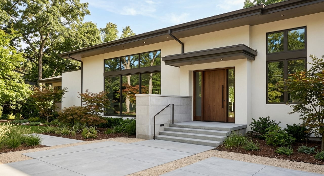
Historic East End Living in Alameda
If the waterfront offers openness and shoreline access, the Historic East End offers a more classic Alameda experience. This side of the island is closely tied to Park Street, streetcar-era neighborhood patterns, and Alameda’s older architectural fabric.
The city describes Park Street and Webster Street as pedestrian-oriented main-street districts with historic development patterns. It also notes that the Park Street Historic District is listed on the National Register of Historic Places, reinforcing the East End’s long-established character.
What East End Lifestyle Feels Like
The East End often appeals to buyers who want historic character, a tighter street grid, and more of a neighborhood-on-foot experience. Alameda’s general plan notes 17 neighborhood station districts clustered around historic streetcar stations, which helps explain why this part of the city can feel more compact and layered.
Your daily routine here may look very different from a waterfront routine. Instead of relying on larger retail centers, you may find yourself walking to Park Street businesses, local services, or dining destinations more often.
The city’s market information describes Park Street as a historic main-street district with a restored art deco movie palace and a vibrant evening scene. That supports a more traditional main-street lifestyle, with errands and social plans centered in a more compact area.
East End Walkability and Access
Walkability is one of the East End’s biggest strengths. The city says Park Street and Webster Street are pedestrian-oriented districts, and it notes that historical development patterns in these areas limit off-street parking.
That older pattern tends to support a more walkable environment. The city also says the Civic Center Garage is within a 10-minute walk of nearly all Park Street businesses, and its Commercial Streets Program expanded outdoor dining and sidewalk space along the core corridors.
For buyers who want the option to do more on foot, this side of Alameda often stands out. It can feel easier to build daily habits around nearby blocks rather than around destination shopping centers.
East End Schools and Practical Convenience
For many buyers, school logistics are part of the neighborhood decision. Alameda Unified School District says it is a neighborhood-school district, and in most cases children attend schools zoned for their home address.
That matters because central Alameda and the East End have a dense cluster of campuses. District and school sites identify Edison Elementary near Park Street and Central Avenue, Paden on Central, Franklin on San Antonio, Maya Lin on Taylor, Wood Middle on Sandcreek, and Alameda High on Central.
This supports a practical takeaway for buyers comparing Alameda neighborhoods. Based on school locations and the district’s address-based model, central Alameda often offers one of the broadest concentrations of nearby campus options.
Historic Rules Buyers Should Know
The East End’s charm can come with added planning considerations. The city says that work on contributing structures in historic districts can require a Certificate of Approval, and demolition of many pre-1942 structures is regulated.
If you love older homes and architectural detail, this may be part of the appeal. At the same time, if you are planning major changes, it is important to understand the city’s historic-preservation framework early in your search.
Waterfront vs Historic East End
If you are deciding between the two, the best fit often comes down to how you want your days to work.
| Lifestyle Factor | Waterfront Alameda | Historic East End |
|---|---|---|
| Overall feel | Shoreline-oriented, open, varied by area | Historic, established, traditional grid |
| Commute style | Strong ferry access in several areas | Strong bus access, rail transfers via Oakland |
| Daily errands | Larger shopping centers and destination retail | Main-street businesses and compact walkability |
| Outdoor access | Beaches, promenades, shoreline parks, trails | Walkable streets, nearby commercial corridors |
| Housing context | Mix of redevelopment, mixed-use, shoreline neighborhoods | Older homes, historic districts, pre-1930 fabric |
| Key planning issue | Flood adaptation and shoreline resilience | Historic-preservation review for some properties |
How to Choose the Right Side of Alameda
If you are still narrowing it down, start with a few practical questions:
- Do you want a ferry-based commute to San Francisco?
- Do you prefer a beach, promenade, or trail-oriented setting?
- Would you rather handle errands at larger shopping centers or on a historic main street?
- Is architectural character a top priority?
- Do you want to be especially mindful of historic-district rules or shoreline flood planning?
- How important is proximity to address-based school assignments?
For many buyers, the waterfront is the better match if your priorities are views, trails, beaches, newer redevelopment areas, and ferry access. The East End is often the better match if you want historic character, tighter walkability, practical school access, and a more traditional neighborhood pattern.
There is also an important nuance here. Not all waterfront areas feel alike, and not all East End homes have the same planning context. Some shoreline areas are newer and mixed-use, some are beach-and-retail oriented, and some feel more separate. Likewise, some East End shoreline-adjacent blocks may still sit in active flood-planning areas, so it helps to look beyond the broad label and evaluate each micro-location carefully.
The good news is that Alameda gives you real variety within one city. Whether you are drawn to bay views and ferry terminals or classic streets and historic homes, a thoughtful home search can help you find the part of the island that fits how you actually want to live.
If you are comparing Alameda neighborhoods and want a more tailored read on lifestyle, property fit, and market positioning, the Anthony Riggins Team can help you evaluate the options with clarity.
FAQs
What is the difference between waterfront and East End living in Alameda?
- Waterfront Alameda generally offers more shoreline access, ferry options, open space, and larger retail centers, while the Historic East End is known for older homes, Park Street walkability, and a more traditional neighborhood grid.
Which Alameda area is better for commuting to San Francisco?
- Waterfront areas may offer an advantage if you want direct weekday ferry service, since the city says Seaplane Lagoon and Harbor Bay ferries serve San Francisco, and Main Street Ferry also connects to San Francisco.
Are East End Alameda homes in historic districts?
- Some are. The city says the Park Street Historic District is on the National Register of Historic Places, and certain work on contributing structures in historic districts can require a Certificate of Approval.
Are waterfront homes in Alameda affected by flood planning?
- Some shoreline and low-elevation areas are part of the city’s flood-resilience and adaptation planning, so buyers should review whether a specific property sits in a waterfront or shoreline-adjacent area with active planning considerations.
Which Alameda area is more walkable without a car?
- The Historic East End often stands out for compact walkability because Park Street is a pedestrian-oriented main-street district with a dense cluster of businesses and services.
How do school assignments work in Alameda neighborhoods?
- Alameda Unified School District says it is a neighborhood-school district, and in most cases children attend schools zoned for their home address, so location can directly affect school assignment.